Tuesday, August 29, 2006

Coming Attractions

I've got big plans for this little blog. Here's a prevue of what's to come (as well as a check list to help me keep track of the stuff that I want to do):


  • Did you know the google maps pedometer now displays roads for non-US countries? It does! So I'll be tracing out the route that I took on my New Zealand adventure this spring. It'll be neat to see exactly what kind of mileages (kilometerages?) and climbs I did. I'll also include my correspondences to the folks back home, for narrative goodness.

  • I intend do a full write up of RAO Speedwagon's Race Across Oregon title defense, including a map of the route (which I've also ridden as a bike tour.)

  • I'll also trace out trips that I've taken to Salem (OR), Seattle, High Rock, Lost Creek, Lolo Pass (Barlow Century), the Three Capes, and the Bridge of the Gods.

  • I'll give a photo-tour of the equipment (i.e., bikes) that I use on my expeditions, as one can never have too much bike pr0n around.

  • I'll put together a catalogue of roads that I'm interested in exploring, with some ideas for rides that I might take to facilitate said exploration. By the way, if anyone out there has a suggestion for a road or area around here for me to check out, by all means, lay it on me.


So, if any of that interests you, check back in the coming weeks!

Wednesday, August 23, 2006

8/18/06 to 8/21/06 -- North Oregon Coast, 320 miles

Riding to the Oregon Coast represents something of a holy grail to many budding bike tourists in the Portland area. The beach is a wonderful destination that seems just close enough to be doable. And once you get there, there's the whole Oregon Coast Bike Route to pedal. But there are a number of obstacles to getting there that can pose quite a challenge if you're not prepared for them. There's enough interest in the trip that the Portland Office of Transportation even has a web resource on the topic. (For the record, I much prefer the two options that they list as "alternates" to the main routes that they illustrate.)

I made my first trip to the coast when I was home from college for the summer, riding to Astoria on one of the hottest days of the year, and it was one of the first loaded tours I ever did. I made it, but only just. Since then, I've figured out a bunch of the important details to help me get all the way out there in good shape. Every year, OHPV has a campout at Ft. Stevens State Park, and I ride my bike out. This has given me plenty of chance to refine my route.

To make the trip this year, I put my gear into my Radical Designs recumbent panniers so that I could take my Aero. These bags let me carry enough on that sporty bike for a light weekend tour without having to compromise the bike's highest and best use by putting a rack on it.

I left Portland by crossing the St. John's bridge and heading north on US 30. In the past, I took 30 all the way to Astoria. And one can do that, but it's not too fun (even though there's a generous shoulder) mainly because of a large volume of high-speed traffic. But the first 50 miles isn't too bad, and I turned off after 20, in Scappoose.

My latest favorite route to Astoria is via OR 202, which is a beautiful, quiet, flat road that goes through the coastal mountains of northwest Oregon at more or less river grade. The route basically starts in Vernonia, though, and one has three options for getting there. I've tried the road through Timber and OR 47, and both are pretty good options. By going to Scappoose, I was finally getting around to trying the third option: via the Scappoose-Vernonia road.

I found it to be a fine route for riding. No shoulder and a stiff climb, of course, but not much traffic and fine scenery. Then the road flattened out, and these conditions continued all the way through Mist, Birkenfeld, and Jewell. Past the Jewell Wildlife Refuge, the road began climbing up to the summit of the coast range, and a couple miles later, I had a wide open downhill the rest of the way to camp.

I wasn't quite at my destination, though, and I still had some exploring that I wanted to do. So rather than take 202 into Astoria, I turned a little early, onto the Olney Cutoff Road. This took me to Young's River Road, and up to Young's River Falls (which was a beautiful spot, well worth the detour). From the map, I wanted to turn onto Turner Creek Lane, but missed it because it wasn't signed. So I ended up on familiar ground heading into camp on the 101 business loop.

This made for a long (120 mile) day, but the trip could easily be done in two, and splits into nice 60 mile pieces if you overnight at either Vernonia City Park or Big Eddy County Park.

I spent Saturday socializing and generally having a good time. Much of that was done while riding. The back road route down to Seaside is wonderful, and beats the pants off the 101 route both in terms of scenery and traffic, with gentle, easy rollers and only a single climb to get you out of the river valley and over the hill into Seaside. Also, for next year's get together, I'm planning to lead a Saturday ride out to Young's River Falls, and up to the Astoria Column. (You can see some of the roads that my route will follow on the right side of the map here.) There's also some nice riding just within the park, which was a little more detail than I wanted to get into. Still in all, a day of social rides that totaled a surprising 80 miles when all was said and done.

Sunday, I hung around and spent time with friends until around noon, when Mike Porter and I headed south. Our destination was Barview Jetty County Park, where there's a terrible campground with awesome hiker-biker sites. We basically just stayed on 101 the whole way, with a small side trip into Cannon Beach for lunch. Even with the late start, it was a very humane day at 50 miles.

If I had never ridden the coast before, or if we hadn't waited until 12 to start out, I would have taken some of the lower traffic, scenic backroads such as the Lewis & Clark River Road and the Miami River Road. As it stands, though, 101 on the Oregon Coast isn't too shabby in the southbound direction at least. ODOT favors that shoulder when they have to make a choice, and that the wind blows out of the northwest. So it's best to go south (feels like going downhill). The traffic is annoying in either direction.

Finally, for my last day on the road, I continued on 101 to the outskirts of Tillamook, where I got on the Wilson River Loop/Latimer Road. That saved me from having to deal with downtown Tillamook, and dropped me off on highway 6. Highway 6 is another of my favorite routes to the coast -- it's beautiful, the pavement is good, the shoulders are fine, and the traffic is moderate. What recomends this route most to the beginner is that it consists of a single climb that summits at around 1600', and descends the rest of the way to the coast (or inland, if you are heading east).

I took my time, stopping at the River's Edge Grill for an awesome chocolate chip cookie, exploring some intriguing rock stairs that turned out to lead up to a waterfall, and checking out the new Tillamook Forest Interpretive Center. After I crested the summit, I zipped down the other side, 9 miles to the junction with highway 8, and turned onto that. That took me through lovely rural Gales Creek Valley to Forest Grove, and from there I continued on 8 through the much less scenic portion that goes through Cornelius to Hillsboro. There, I got on the MAX, as I felt that riding through the western suburbs of Portland represented very little added value to my bike tour. Ending the ride at that point meant that the final day of my little tour weighed in at around 75 miles.

The whole ride:
Here is a link to the pictures I took on the trip.

Here is a link to the loop in gmaps.

Here is a link to the local rides that I did around Fort Stevens. This might be of interest because it shows the back road to Seaside, and it shows how I would have gone into Fort Stevens if I hadn't missed the turn onto Turner Creek Lane.

Wednesday, August 16, 2006

7/9/2005 -- Longview Loop, 120 miles

I've done this ride twice, most recently on the first day of Seattle to Portland (StP) in 2005. After training hard all spring, my friend Dave was going to do StP in one day for the first time. My friend Carolyn and I wanted to give him some encouragement by riding the last 50 miles or so with him, or by at least saying hi to him at the Lexington rest stop. So on a cool July morning, we saddled up the Tour Easies and headed north.

The first half of this ride, the northbound leg to Longview, was another piece of map-inspiration. After a particularly unpleasant experience on Highway 30, I wondered if there was a reasonably direct alternate route between Portland and Longview. A little digging in Google maps gave me a good candidate on the Washington side, so in early spring of 2005, I checked it out. Then Carolyn and I refined it a little bit when we did this ride.

We started off by going across the I-5 bridge and straight up Columbia Street for a couple miles. Then we jogged over to Hazel Dell, and stayed on that for a while, and then finally over to highway 99. As you might guess, 99 isn't that great a road, but at least has a bike lane, and is pretty much par for the course for suburban riding.

Eventually, we cut over one more time to 29th St., zoomed down a big hill, and found ourselves out in the country. At this point the scenery took a big change for the better -- farmland, pastures, forests, and gently rolling hills all the way into La Center. In La Center, we pedaled past the tacky casinos, briefly got on the RACC route, but in reverse, and continued on the Old Pacific Highway towards Woodland.

That stretch of the Old Pacific Highway winds on the side of a hill through lush greenery, which reduces nearby I-5 to a mere rumor. Before we knew it, we had crossed the Lewis River and entered Woodland. We passed through Woodland efficiently, taking an I-5 frontage road, and then after a couple turns, found ourselves on Green Mountain Road.

Green Mountain Road is appropriately named. It goes up a mountain, and a fairly steep one at that. It's about 3 miles and change of tough grades to the top. Fortunately, the road was very quiet, and when we reached the summit, we were treated to a spectacular and unusual view of the lower Columbia River. The descent down the other side was quick and twisty, and deposited us onto Cloverdale Road. Cloverdale Road rolled into Kalama through some pretty tree-covered hillsides with small farms nestled in them, but we heard a bit more of I-5 in this stretch.

We stopped in Kalama for a short break, and learned about that town's Polynesian(!) origins. Then we pressed on for Longview on more low-traffic roads, and though the scenery wasn't quite as nice as before, we did cross an intriguing looking road a couple miles out of Kalama that seemed to follow the Kalama River up towards Mt. St. Helens, and which promised some potential bike-camping opportunities.

Traffic got gradually denser until the interchange with 432 and I-5. At that junction, we got on the on-ramp for I-5 to Seattle, but at the last minute turned off on Kelso Dr. From there, it was a fairly trivial matter to get into downtown Longview, and north to the big StP rest stop at Lexington.

At Lexington, we soon met up with our friends Bill Phillips, Rand Milam, and Rand's brother Kip, and had a great time socializing with them. Carolyn and I realized that Dave was probably still a good ways from Longview, and I had to get home to take a phone call that I was expecting from a friend who was living in New Zealand, so we left the rest stop with Bill and Rand.

The rest of the ride was just following the StP route home. Go through Longview, cross the Lewis and Clark Bridge, and get on Highway 30 all the way into town. Not a terrible ride -- pretty nice scenery, and certainly more fun and easier with 2000 other cyclists on the road, but also still more traffic than we had had to contend with for the first half of the trip.

Here is a link to the route on the gmaps pedometer.

Monday, August 14, 2006

7/8/2006 to 7/12/2006 -- RAO Recon, 200 miles

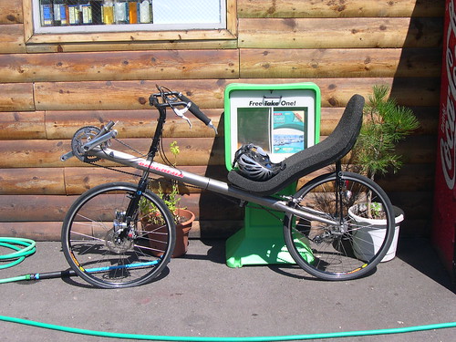
So far, I've talked about long single-day rides. It's a whole lot of fun to go out and knock out 160 miles in a day, over river, hill, and mountain -- you know that you've done something with your day. But it takes a certain amount of athleticism to be on the bike for that long, and those kinds of distances are especially hard on my cycling brothers and sisters who have not yet discovered the joys of recumbents.

So let me just point out that there is no reason why any of these rides has to be done in a single day. The ride that is the subject of this post could have easily been done in one, especially if I had elided the side-trip up Lolo Pass. But I thought it would be more fun to take it easy, to spend some time in the outdoors, and to take the chance to enjoy myself.

Last year, my friend Carolyn and I did a self-supported bike tour out in eastern Oregon to reconnoiter the Race Across Oregon route. This year, I planned to enter the race again, but this time it was not necessary to see the whole route, as it was the same as last year, with a couple small exceptions. However, because we had so much fun last year, we decided to go out and have a look at some of the new bits. There were also a couple roads that I wanted to check out that weren't on the course, but that I just had a curiosity about.

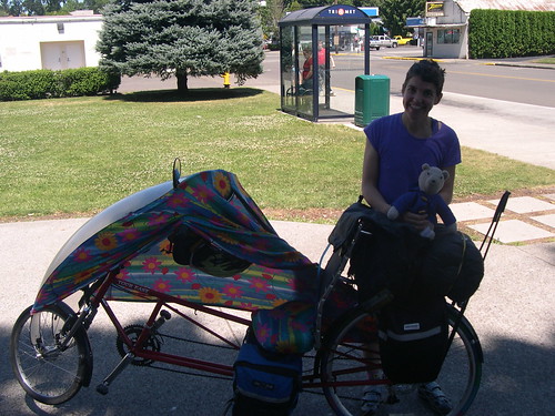
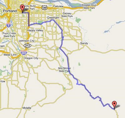
So, we loaded up the Tour Easies and pedalled out of my driveway. Our journey began exactly as my Detroit Lake ride (which I actually did afterwards) began. We rode down the I-205 bike path to the Springwater Corridor, out the corridor to Boring, took Richey and Amisigger to 224, and merrily made our way to Estacada on that road's broad, flat shoulder. We stopped in Estacada for a lunch of meatloaf sandwiches and chocolate.

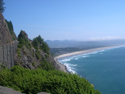
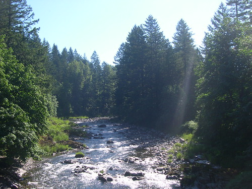
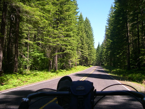
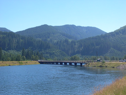
Going out of Estacada, we turned onto Faraday Road, and enjoyed its quiet pavement and views of the river. Then we rejoined 224, and just as it later would on the Detroit ride, the traffic slackened away to nothing once we were past Promontory Park, a mile or so later. We took our time pedalling up the Clackamas River, feeling free to stop to take pictures of the frequent scenic vistas. After an easy, flat 50 miles from my front door, we arrived at the Roaring River campground, and decided to relax there the rest of the afternoon.

We figured that we would get a better workout the second day, and we weren't disappointed. We had a mountain to climb, after all. So we packed up the bikes and started turning the cranks.

A few miles from Roaring River, we had a 1.5 mile climb up to Ripplebrook, where we stopped briefly to get our bearings. The we went a short ways further down 224 to the junction with FR 57, which we were going to take to Timothy Lake.

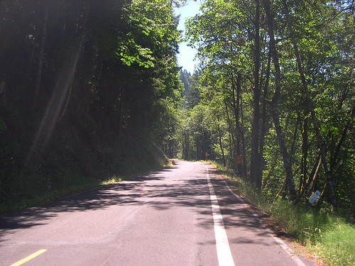
These days, the main road to Timothy Lake is FR 4630, which is gravel. The old main road was 57, but it washed out three years ago, and hasn't been repaired since. However, the slide is a minor one, and it's a matter of a minute to get off your bike, walk it around the washed-out section, and be on your merry way. So, for the second time in our trip, we had a beautiful, smooth, scenic road through the forest all to ourselves.

On the other side of the slide, we zipped back down to the river, and re-joined the main route through some tall old trees with "dispersed camping" scattered throughout. Then, when FR 57 turned to gravel, we took a left up FR 58 towards High Rock.

We could have taken 58 all the way up to Skyline Road (FR 42), but that's a tough climb. On a fully loaded bike, I was daunted, and I figured Carolyn would be too, if she knew what she would be getting into. Fortunately, I drew inspiration from a bike adventure Jonathan Maus wrote up a year or so ago, and after a mile, we turned onto 5810, which parallels 57, but is fully paved.

Well, almost fully paved, anyway.

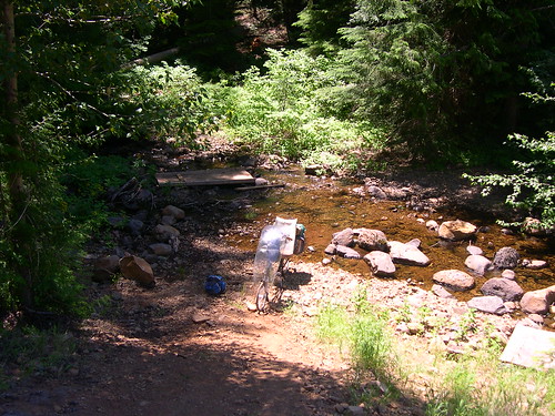
5810 was steep and winding, but we kept plugging away. Then, after 4 miles or so, we hit the summit, and enjoyed smooth sailing down the other side. Then we came around a bend and the pavement ran out. I told Carolyn that we just had to forge on, and that the pavement would pick up again shortly. I projected way more assurance than I had any right to. The road had become a dirt path, and then that dirt path led straight down to a stream and up the bank on the other side. I confidently said that all we had to do was ford the stream and push our bikes up the hill (with no actual knowledge or experience to back up that assertion, other than that I was pretty sure I remembered reading that Jonathan had come this way).

But so we brought our bikes across the stream, ate lunch, and unloaded the bikes in preparation for pushing them up the hill. When we got the first bike to the top, what should we see but that familiar, welcome smooth pavement, picking right up where it left off, just a few yards away. Fortune favors the foolish, indeed.

At Timothy Lake, we were cruising along when disaster struck. Carolyn's bike began swerving uncontrollably from side to side, just spontaneously. She hadn't hit so much as a pebble, but the next thing I knew, her bike went down. She had a serious case of road rash and even burns from the friction and the hot pavement. She sat in the shade while I helped dress her wounds, and then I looked over her bike. It turned out that her headset had come far out of adjustment, and was so loose that the front wheel no longer pivoted on a single point, and thus could not track straight. I tightened the headset down as much as I could, and tried to get her to call it a day, and camp at one of the sites on the lake, but she wanted to press onward.

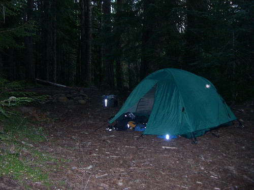
So we continued on FR 42, a beautiful road that winds through some high, dry alpine forests up to 26, and then took that down a quick couple miles to FR 43. 43 featured a couple easy rolling miles, and then a screaming descent to the White River. We scratched our heads for a while, looking for the Barlow Crossing Campground, found it, found the current occupants to be undesirable neighbors, and left. We figured that we'd be better off going off the road and finding a "dispersed" site with less loud music. We found a decent spot in the woods just off the junction of FR 43 and FR 48, and Carolyn cleaned her wounds in the White River.

Poor Carolyn had a rough night -- it's hard to get comfortable lying down when you've got a bunch of road rash. But we fortified ourselves the next morning with coffee and oatmeal, and set out north on FR 48, which did a lot to lift our spirits. It was a pleasant road, well shaded in the morning and with a moderate grade. It undulated uphill to Highway 35, where it joined that road on the blasted floodplain around the White River. The sections on FR 43 and 48 were the entirety of the new RAO sections that we had come to look at, and our verdict was, no problem. Just don't stick the streamliner on them.

On 35, we went 
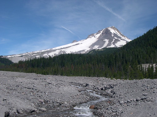
down to Barlow Pass, and then down to the 26-35 junction. 35 is pretty quiet, but 26 is a madhouse, so we had to contend with traffic whizzing by for a couple miles before we crested Summit pass and arrived in Government Camp. We got to Government Camp right at noon, which could mean only one thing: fish tacos! We stopped at the Mt. Hood Brew Pub and each got an order of fish tacos, a beer, and a desert, and drank a bunch of their awesome water (their beer is incredible and I think it's due in large part to the water they use.) I love that place!

Then we went across the highway to the Skibowl Action Park, which I knew had mountain bike rentals. Since they did rentals, I figured they had a shop, and thus a tool to tighten Carolyn's headset. I did not want her screaming down the mountain on a finger-tight headset! All my suppositions proved correct, and we got her bike taken care of.

At the top of the hill, Carolyn took a picture of the truck sign before we flew down the side of the mountain.

In Rhodedendron, we loaded up on more groceries and water, since we knew the water at that night's campground wasn't so great. After loading up the groceries, we got onto Lolo Pass road and took it up to FR 1820, then up past McNeil Campground, Riley Horse Camp, and up to Lost Creek. Lost Creek is one of my favorite car campgrounds around -- an oasis of lush growth in a sea of dry, pumicey soil. What's more, the creepy campground host who had been the only blemish on my last couple stays there had been replaced by a really nice couple.

For the fourth day, we wanted to do a hike. So we left our tent set up in our site, and pedaled up FR 1828 to Topspur road. 1828 is a narrow, winding road that is featured on my favorite organized ride, the Barlow Trail Century. It's steep, but almost completely shaded, and very little traffic. The surface is just okay, but certainly good enough for climbing. It's the kind of road where, you'll round the corner, and there'll be a view that'll just take your breath away.

We did pretty well getting up 1828, but we had another 1.5 miles to go on the gravel road to Topspur. We were doing okay, but then Carolyn's wounds and low blood sugar combined with the tough climb and lousy surface and we had to take a break. Just around the next bend, though, we made it to the trailhead. We ate some lunch and felt a lot better.

From the Topspur trailhead, we hiked around Bald Mountain and up to McNeil Point. Carolyn had been here the previous week without her camera, and the wildflowers had been a riot. So she wanted to come back, and when she realized we'd be in the area, suggested that we do a day trip up here. We had to pedal on gravel, and hike in bike shoes, but we still managed to scramble up and down the steep slopes up to the McNeil shelter. We were rewarded for our efforts by an amazing display of beautiful plants and views of distant glacier-fed waterfalls.

Before long, a cloud rolled in and threatened to catch us up there on the exposed ridge, so we beat a hasty retreat back to our bikes. At that lower elevation, the weather was much more stable, and we had no trouble at all on the roaring descent on FR 18 back to our campsite.

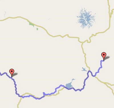
The last day started off grey. The clouds that had chased us off the ridge the day before had established themselves to the horizon, and packing up I felt a couple ominous drops. We broke camp and enjoyed the steady descent down the Muddy Fork Road, and then down Lolo Pass Road to the Barlow Road. The Barlow Road is another route that I was introduced to by the Barlow Century, and I think it's an absolutely wonderful piece of pavement. Easy going up, speedy going down. Fun twists to keep it interesting, but no turns that require you to even think about reaching for your brakes. Gorgeous scenery, gorgeous surface, low traffic, and keeps you from having to do Highway 26. What's not to love?

We've done a couple of trips just out to Lost Creek before, and it's a great 2 or 3 day excursion. Usually we lift the Barlow Century route wholesale, and take roads that go over a hill called The Devil's Backbone each way. But with the weather going bad, I wanted to get home, so we got onto Sleepy Hollow Road, and took that to 26. We pushed on up 26 to Sandy. There are a couple other back roads that parallel 26 that might have worked (Cherryville, etc.), but I didn't think it would be a good idea to go exploring, under the circumstances. I'll have to go look at them before the summer's out, though. In Sandy, we got on Bluff Road, and turned left on Dunn to 352nd, and then onto Compton, which took us straight into Boring. This turned out to be a reasonable route between Sandy and Boring that doesn't require you to get on Highway 26. Nice!

From Boring, we just picked up the Springwater, and from there, the ride home is a pretty trivial exercise.

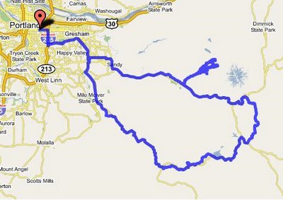
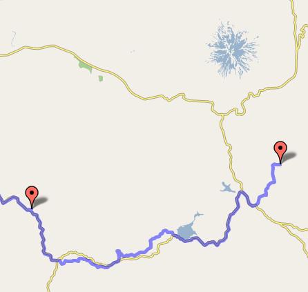
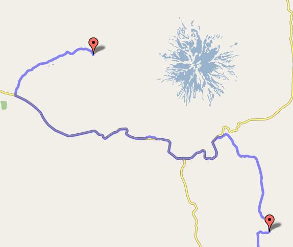
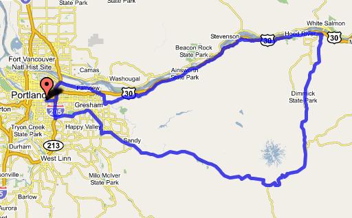
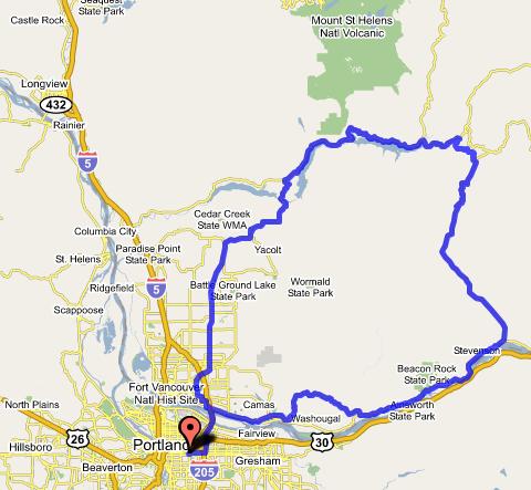
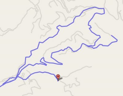
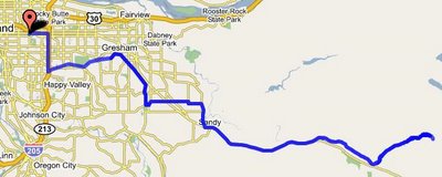
Here's a map of the whole route.

I would highly recomend this loop to the novice bike tourist. The days are 50 miles or less, the roads are quiet and pretty, and there are lots of camping options so you can always knock off early if a day is too much for you, or later if you want to keep pedaling. Plus, if you take the Devil's Backbone option (which I'll illustrate in a future post), the only time you're climbing on Highway 26 is between the 26-35 junction and Government Camp. The rest of the time, you hardly even have to think about cars. Good stuff!

Here are the rest of my photos.

Here is a link to the route in the gmaps pedometer.

Thursday, August 10, 2006

8/27/2005 -- Mt. Hood, 160 Miles


If there wasn't already a local ride called "The Big Lebowski", I think this one would be a good candidate for that moniker. What could be a bigger Lebowski than completely circumnavigating a mountain, including bagging 3 of its passes?

I got a chance to do this ride for the first time late last summer, and enjoyed it immensely, both for the sheer challenge of it, and for the wonderful roads that I got to explore along the way. This is definitely a ride that I will be returning to (though at the moment there's a fire in the Elk Meadow area that has closed highway 35 up to Bennett Pass).

I started out by heading out of town on Marine Drive, enjoying the smooth, level road to Troutdale. Then I went up the Historic Columbia River Highway, over Chanticleer Point, and down through waterfall country. These roads are the bread and butter of most Portland area riders, but it was fun to go out on them knowing that I'd be coming back a different way.

Finally, past Warrendale, I had to get onto I-84 for about 2 miles. Not the most fun road in the world, but plenty of shoulder, and not too much trash. Supposedly, Congressman Peter DeFazio is looking into funding enough connections to make it possible to pedal from Portland to The Dalles without having to go on 84, which would be lovely. Truth be told, it's not a terribly challenging project, actually, as there are only two gaps left that I know about (more on the second in a moment).

I got off of 84 at Bonneville, and got on the 6 mile stretch of the HCRH that is only open to bike and pedestrian traffic, which I took into Cascade Locks. Through town, onto Forest Lane (pretty much a frontage road), and then Herman Creek Road. Not overly scenic (although there's always something pretty to look at in the gorge), and not quiet (next to 84), but very little traffic, so good enough. Finally, Herman Creek Road ended, and I had a choice to make: either get back on the freeway, or turn right to take a back road on over to Wyeth, which I wasn't very knowledgeable about.

Being an adventuresome soul, of course I took the road to Wyeth. Nice road, but very steep. Lots of false summits, and each time the climbing resumes, it comes back steeper than before. But it kept me off of 84 for a few miles, and got me some very nice scenery. Finally, though, I had to get back onto the freeway for the last pull into Hood River.

The stretch of freeway between Wyeth and Hood River is pretty hairy. It's 12 miles, and there is a hair-raising half mile or so where the shoulder gets a lot narrower than I am comfortable with. The one saving grace of this piece of road is that you almost always have a tailwind in the summer. Get it done, Representative DeFazio!

I stopped briefly in Hood River to ask whether I was better off going south on 35 or the Hood River Highway. I ended up taking 35, but it was pretty exposed; next time I'll try the Hood River Highway. 35 features several large stair-steps before you get up to Parkdale, where it starts climbing steadily up the mountainside. Though out in the open, the road did feature very little traffic -- it occurred to me that the ski traffic would be non-existant in the summer, and that almost any two points that one might haul freight between would be better connected by 26, 84, or 197, so no trucks, either. And the scenery was absolutely stunning.

Finally, I attained the summit at Bennett Pass. From there, it was actually an easy descent down to the next pass, Barlow, and not much further to the third and final pass of the day, Summit Pass at Government Camp. I got some much-needed dinner at the Mt. Hood Brewing restaurant, and then positively flew home via 26 to Boring, and the Springwater Corridor the rest of the way. Gov't Camp to my front door, 55 miles in under 2.5 hours. Smokin'! But then, that's what descending 3500 feet will get you.

Here's the route on gmaps:

http://www.gmap-pedometer.com/?r=353536

Tuesday, August 08, 2006

7/1/2006 -- Old Man Pass, 165 miles


The idea for this ride came (as so many of my ideas for rides do) from staring at a map. I was looking at the backroads of southwest Washington, and tracing the little filaments that represented roads as they wound around north of the Columbia River. Pretty soon I saw one that went all the way through to the Lewis River. "I wonder if that's paved," I thought. If it was, then it would be possible to make a very long, but still doable loop that starts off going up the Columbia Gorge, and ends up in the foothills below Mt. St. Helens before coming back home through Vancouver.

Well, only one way to find out. When a day came up that I could dedicate to a long ride, I got up early and set out on my sport touring/racing bike, a Bacchetta Aero.

I started off, as I often do, on the I-205 bike path, which I took over to Vancouver. There, I got on the old Evergreen Highway and headed east. The road surface was mediocre, and there was no shoulder to speak of, but also no traffic. This took me through downtown Camas to Washougal, where I turned north on the Washougal River Road. This is a slight detour from the more standard SR-14 route up the Washington side of the gorge, but a very pretty one. It's an easier grade, too (not that I mind a good climb), and the traffic is generally lighter and calmer. So, on the balance, worth an extra couple miles.

The rest of the ride out to Carson is easy and scenic, with smooth pavement, a good shoulder, and a reliable tailwind (in the summer). I stopped both in Stevenson and Carson to have a bit of a snack, and then proceeded up the Wind River Road, which is long and straight. Some decent shoulder and decent pavement. Traffic falls off as you go north, but near Carson, there's a pretty fair amount of it. Then, when you get to the junction with "Meadow Creek Road" (which is only named that on the maps, as far as I can tell -- the signage on the road still indicated "Wind River Road"), you have pretty much the whole road to yourself. There's a gorgeous camping option at the base of this ride's big climb, at Paradise Creek Campground.

The climb up to Old Man Pass is a 7 mile long grind. The road snakes around up the side of the hill, and keeps going around corners. I kept seeing blue sky around the next bend, which often indicates that there is downhill on the other side. This kept happening, and the terrain around the bend kept featuring more up. It'd be more fun now, knowing exactly what I was in for. So be warned: it's 7 miles from Paradise Creek to the top of Old Man Pass. Period.

At the top, I took another blow. A sweet couple in an RV got to chatting with me, and I mentioned that I would kill for a popsicle. They generously offered me a cold Sprite, which was just as good. Thus fortified, I proceeded down the hill.


There was a small downhill followed by a couple miles of flat/rolling terrain at the top of the pass, and then I turned left onto Curly Creek Road. Around a corner, and blammo, there was Mt. St. Helens in all her glory. I got some great pictures at McClellan Viewpoint, and blasted down a technical descent to FR-90. The last stretch of Curly Creek Road was a straight, steep section that plummeted down a corridor of trees, with the mountain right in front of you. Eminently picture-worthy, but I was doing 45+ at the time, and not inclined to stop.

There was a resort at Northwoods where I had some more food, and chatted with some backroads mountain bike cyclotourists. Ah, there's something I'd love to try soon! They raved about having hundreds of miles of roads, all to themselves. The thrill of exploration, peace and quiet, and beautiful scenery; what's not to love?

From Northwoods on, the traffic picked up a bunch. FR-90 and then WA 503 zig-zagged around the northern edges of first Swift Creek Reservoir, and then Yale Lake. It was some fairly challenging, rolling terrain without too much extra room on the road. Past Yale Lake, I stayed on 503 through Amboy and into Battleground. I would not recomend this at all -- 503 is a steep, windy road with lousy sight lines and too much traffic. Take 503 to Amboy, but then pick up the RACC route by either going southeast to Yacolt and Moulton Falls, or even better, by going west on Cedar Creek Road and going over the hill at 21st to La Center. The route from La Center south is much nicer and safer than the stretch of 503 from Amboy to Battleground.

When I finally did get to Battleground, cycling conditions on 503 improved quite a bit, but there was still a distastefully high level of traffic, and the scenery was terrible. It did the job, though, and got me to Orchards, where I stopped for a Burgerville cheeseburger and shake before I found my way through eastern Vancouver back to the Glen Jackson Bridge.

Pictures here:
http://www.flickr.com/photos/49813305@N00/sets/72157594202815279/

Gmaps route here:
http://www.gmap-pedometer.com/?r=347662

Monday, August 07, 2006

8/5/2006 -- Detroit Lake, 200 miles


Late last summer, I finally got a chance to ride on Highway 224, up the Clackamas River. I fell in love with the area for biking, and since then I've daydreamed about doing a ride to explore the entire length of that highway. On Saturday, I got up early and set out on my custom Bacchetta Aero to do just that.

There's nothing easier than getting to Estacada from central Portland; simply follow the Springwater Corridor to its terminus in Boring, follow Richey and Amisigger down the hill, and get on the generously-shouldered 224 to Estacada. And then, just past town, divert onto Faraday Road (the old Highway 224) for 5 miles of car-free bliss, right above the river. Rejoin 224, and past Promontory Park traffic on the highway diminishes into nigh non-existence.

For the next 70 miles, pedal through beautiful forests, above roaring rapids, and below basalt cliffs. Except for a snack stand at Ripplebrook, there are no services in this stretch, so pack a lunch. The trees for the last 15 miles or so before the pass above the Breitenbush River are rather generic second growth stock, but upon plummetting down the other side, the forest regains a lush, older growth character.

Detroit has plenty of options for refueling, and represents something of a high point, elevation-wise, in the ride. The next 30 miles consist of gradually descending rollers, and feature a fairly heavy accompaniment of traffic. To it's credit, the road here also has a pretty good shoulder. I had a nasty headwind for this stretch, which was somewhat demoralizing, given the traffic, and given how much effort I had already expended on the day. Plenty of services in this stretch.

When I got to Stayton, I turned north on the Cascade Highway, west of Silver Falls Park. This road is straight, but crosses a number of drainages of the foothills of the Cascades. So it's pretty hilly. Once I got to Silverton, I proceeded north over the pancake-esque Elliott Prairie on Meridian Road, which took me to within spitting distance of Canby, and from there I took my pick of several options to get me back within Portland proper.

Here's the route in gmaps:
http://www.gmap-pedometer.com/?r=347558