7/1/2006 -- Old Man Pass, 165 miles
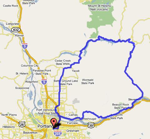
The idea for this ride came (as so many of my ideas for rides do) from staring at a map. I was looking at the backroads of southwest Washington, and tracing the little filaments that represented roads as they wound around north of the Columbia River. Pretty soon I saw one that went all the way through to the Lewis River. "I wonder if that's paved," I thought. If it was, then it would be possible to make a very long, but still doable loop that starts off going up the Columbia Gorge, and ends up in the foothills below Mt. St. Helens before coming back home through Vancouver.
Well, only one way to find out. When a day came up that I could dedicate to a long ride, I got up early and set out on my sport touring/racing bike, a Bacchetta Aero.
 I started off, as I often do, on the I-205 bike path, which I took over to Vancouver. There, I got on the old Evergreen Highway and headed east. The road surface was mediocre, and there was no shoulder to speak of, but also no traffic. This took me through downtown Camas to Washougal, where I turned north on the Washougal River Road. This is a slight detour from the more standard SR-14 route up the Washington side of the gorge, but a very pretty one. It's an easier grade, too (not that I mind a good climb), and the traffic is generally lighter and calmer. So, on the balance, worth an extra couple miles.
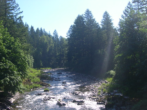
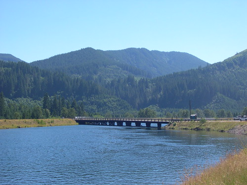
The rest of the ride out to Carson is easy and scenic, with smooth pavement, a good shoulder, and a reliable tailwind (in the summer). I stopped both in Stevenson and Carson to have a bit of a snack, and then proceeded up the Wind River Road, which is long and straight. Some decent shoulder and decent pavement. Traffic falls off as you go north, but near Carson, there's a pretty fair amount of it. Then, when you get to the junction with "Meadow Creek Road" (which is only named that on the maps, as far as I can tell -- the signage on the road still indicated "Wind River Road"), you have pretty much the whole road to yourself. There's a gorgeous camping option at the base of this ride's big climb, at Paradise Creek Campground.
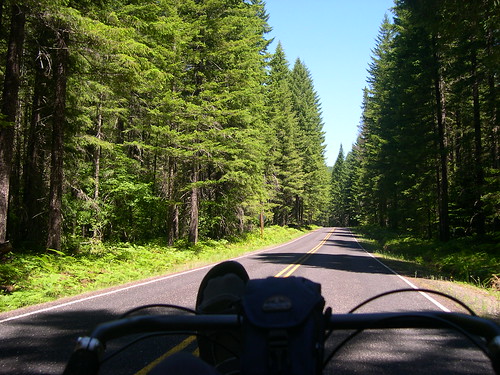 The climb up to Old Man Pass is a 7 mile long grind. The road snakes around up the side of the hill, and keeps going around corners. I kept seeing blue sky around the next bend, which often indicates that there is downhill on the other side. This kept happening, and the terrain around the bend kept featuring more up. It'd be more fun now, knowing exactly what I was in for. So be warned: it's 7 miles from Paradise Creek to the top of Old Man Pass. Period.
At the top, I took another blow. A sweet couple in an RV got to chatting with me, and I mentioned that I would kill for a popsicle. They generously offered me a cold Sprite, which was just as good. Thus fortified, I proceeded down the hill.
 There was a small downhill followed by a couple miles of flat/rolling terrain at the top of the pass, and then I turned left onto Curly Creek Road. Around a corner, and blammo, there was Mt. St. Helens in all her glory. I got some great pictures at McClellan Viewpoint, and blasted down a technical descent to FR-90. The last stretch of Curly Creek Road was a straight, steep section that plummeted down a corridor of trees, with the mountain right in front of you. Eminently picture-worthy, but I was doing 45+ at the time, and not inclined to stop.
There was a resort at Northwoods where I had some more food, and chatted with some backroads mountain bike cyclotourists. Ah, there's something I'd love to try soon! They raved about having hundreds of miles of roads, all to themselves. The thrill of exploration, peace and quiet, and beautiful scenery; what's not to love?
 From Northwoods on, the traffic picked up a bunch. FR-90 and then WA 503 zig-zagged around the northern edges of first Swift Creek Reservoir, and then Yale Lake. It was some fairly challenging, rolling terrain without too much extra room on the road. Past Yale Lake, I stayed on 503 through Amboy and into Battleground. I would not recomend this at all -- 503 is a steep, windy road with lousy sight lines and too much traffic. Take 503 to Amboy, but then pick up the RACC route by either going southeast to Yacolt and Moulton Falls, or even better, by going west on Cedar Creek Road and going over the hill at 21st to La Center. The route from La Center south is much nicer and safer than the stretch of 503 from Amboy to Battleground.
When I finally did get to Battleground, cycling conditions on 503 improved quite a bit, but there was still a distastefully high level of traffic, and the scenery was terrible. It did the job, though, and got me to Orchards, where I stopped for a Burgerville cheeseburger and shake before I found my way through eastern Vancouver back to the Glen Jackson Bridge.
Pictures here:
http://www.flickr.com/photos/49813305@N00/sets/72157594202815279/
Gmaps route here:
http://www.gmap-pedometer.com/?r=347662
posted by Michael at 9:04 AM
![]()

0 Comments:
Post a Comment
<< Home