7/8/2006 to 7/12/2006 -- RAO Recon, 200 miles
 So far, I've talked about long single-day rides. It's a whole lot of fun to go out and knock out 160 miles in a day, over river, hill, and mountain -- you know that you've done something with your day. But it takes a certain amount of athleticism to be on the bike for that long, and those kinds of distances are especially hard on my cycling brothers and sisters who have not yet discovered the joys of recumbents.
So let me just point out that there is no reason why any of these rides has to be done in a single day. The ride that is the subject of this post could have easily been done in one, especially if I had elided the side-trip up Lolo Pass. But I thought it would be more fun to take it easy, to spend some time in the outdoors, and to take the chance to enjoy myself.
Last year, my friend Carolyn and I did a self-supported bike tour out in eastern Oregon to reconnoiter the Race Across Oregon route. This year, I planned to enter the race again, but this time it was not necessary to see the whole route, as it was the same as last year, with a couple small exceptions. However, because we had so much fun last year, we decided to go out and have a look at some of the new bits. There were also a couple roads that I wanted to check out that weren't on the course, but that I just had a curiosity about.
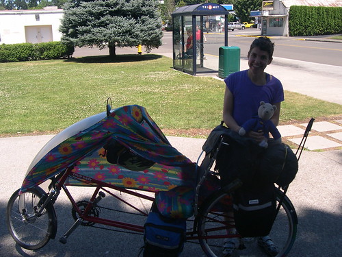 So, we loaded up the Tour Easies and pedalled out of my driveway. Our journey began exactly as my Detroit Lake ride (which I actually did afterwards) began. We rode down the I-205 bike path to the Springwater Corridor, out the corridor to Boring, took Richey and Amisigger to 224, and merrily made our way to Estacada on that road's broad, flat shoulder. We stopped in Estacada for a lunch of meatloaf sandwiches and chocolate.
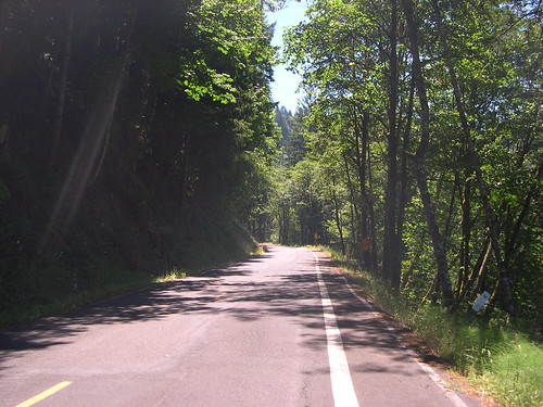 Going out of Estacada, we turned onto Faraday Road, and enjoyed its quiet pavement and views of the river. Then we rejoined 224, and just as it later would on the Detroit ride, the traffic slackened away to nothing once we were past Promontory Park, a mile or so later. We took our time pedalling up the Clackamas River, feeling free to stop to take pictures of the frequent scenic vistas. After an easy, flat 50 miles from my front door, we arrived at the Roaring River campground, and decided to relax there the rest of the afternoon.
 We figured that we would get a better workout the second day, and we weren't disappointed. We had a mountain to climb, after all. So we packed up the bikes and started turning the cranks.
A few miles from Roaring River, we had a 1.5 mile climb up to Ripplebrook, where we stopped briefly to get our bearings. The we went a short ways further down 224 to the junction with FR 57, which we were going to take to Timothy Lake.
 These days, the main road to Timothy Lake is FR 4630, which is gravel. The old main road was 57, but it washed out three years ago, and hasn't been repaired since. However, the slide is a minor one, and it's a matter of a minute to get off your bike, walk it around the washed-out section, and be on your merry way. So, for the second time in our trip, we had a beautiful, smooth, scenic road through the forest all to ourselves.
On the other side of the slide, we zipped back down to the river, and re-joined the main route through some tall old trees with "dispersed camping" scattered throughout. Then, when FR 57 turned to gravel, we took a left up FR 58 towards High Rock.
We could have taken 58 all the way up to Skyline Road (FR 42), but that's a tough climb. On a fully loaded bike, I was daunted, and I figured Carolyn would be too, if she knew what she would be getting into. Fortunately, I drew inspiration from a bike adventure Jonathan Maus wrote up a year or so ago, and after a mile, we turned onto 5810, which parallels 57, but is fully paved.
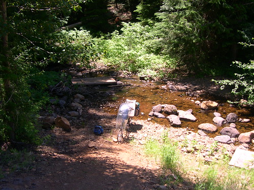 Well, almost fully paved, anyway.
5810 was steep and winding, but we kept plugging away. Then, after 4 miles or so, we hit the summit, and enjoyed smooth sailing down the other side. Then we came around a bend and the pavement ran out. I told Carolyn that we just had to forge on, and that the pavement would pick up again shortly. I projected way more assurance than I had any right to. The road had become a dirt path, and then that dirt path led straight down to a stream and up the bank on the other side. I confidently said that all we had to do was ford the stream and push our bikes up the hill (with no actual knowledge or experience to back up that assertion, other than that I was pretty sure I remembered reading that Jonathan had come this way).
But so we brought our bikes across the stream, ate lunch, and unloaded the bikes in preparation for pushing them up the hill. When we got the first bike to the top, what should we see but that familiar, welcome smooth pavement, picking right up where it left off, just a few yards away. Fortune favors the foolish, indeed.
At Timothy Lake, we were cruising along when disaster struck. Carolyn's bike began swerving uncontrollably from side to side, just spontaneously. She hadn't hit so much as a pebble, but the next thing I knew, her bike went down. She had a serious case of road rash and even burns from the friction and the hot pavement. She sat in the shade while I helped dress her wounds, and then I looked over her bike. It turned out that her headset had come far out of adjustment, and was so loose that the front wheel no longer pivoted on a single point, and thus could not track straight. I tightened the headset down as much as I could, and tried to get her to call it a day, and camp at one of the sites on the lake, but she wanted to press onward.
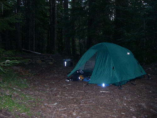 So we continued on FR 42, a beautiful road that winds through some high, dry alpine forests up to 26, and then took that down a quick couple miles to FR 43. 43 featured a couple easy rolling miles, and then a screaming descent to the White River. We scratched our heads for a while, looking for the Barlow Crossing Campground, found it, found the current occupants to be undesirable neighbors, and left. We figured that we'd be better off going off the road and finding a "dispersed" site with less loud music. We found a decent spot in the woods just off the junction of FR 43 and FR 48, and Carolyn cleaned her wounds in the White River.
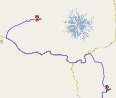 Poor Carolyn had a rough night -- it's hard to get comfortable lying down when you've got a bunch of road rash. But we fortified ourselves the next morning with coffee and oatmeal, and set out north on FR 48, which did a lot to lift our spirits. It was a pleasant road, well shaded in the morning and with a moderate grade. It undulated uphill to Highway 35, where it joined that road on the blasted floodplain around the White River. The sections on FR 43 and 48 were the entirety of the new RAO sections that we had come to look at, and our verdict was, no problem. Just don't stick the streamliner on them.
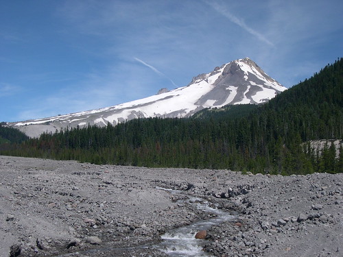 On 35, we went down to Barlow Pass, and then down to the 26-35 junction. 35 is pretty quiet, but 26 is a madhouse, so we had to contend with traffic whizzing by for a couple miles before we crested Summit pass and arrived in Government Camp. We got to Government Camp right at noon, which could mean only one thing: fish tacos! We stopped at the Mt. Hood Brew Pub and each got an order of fish tacos, a beer, and a desert, and drank a bunch of their awesome water (their beer is incredible and I think it's due in large part to the water they use.) I love that place!
Then we went across the highway to the Skibowl Action Park, which I knew had mountain bike rentals. Since they did rentals, I figured they had a shop, and thus a tool to tighten Carolyn's headset. I did not want her screaming down the mountain on a finger-tight headset! All my suppositions proved correct, and we got her bike taken care of.
At the top of the hill, Carolyn took a picture of the truck sign before we flew down the side of the mountain.
In Rhodedendron, we loaded up on more groceries and water, since we knew the water at that night's campground wasn't so great. After loading up the groceries, we got onto Lolo Pass road and took it up to FR 1820, then up past McNeil Campground, Riley Horse Camp, and up to Lost Creek. Lost Creek is one of my favorite car campgrounds around -- an oasis of lush growth in a sea of dry, pumicey soil. What's more, the creepy campground host who had been the only blemish on my last couple stays there had been replaced by a really nice couple.
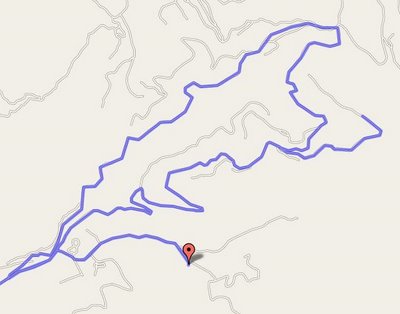 For the fourth day, we wanted to do a hike. So we left our tent set up in our site, and pedaled up FR 1828 to Topspur road. 1828 is a narrow, winding road that is featured on my favorite organized ride, the Barlow Trail Century. It's steep, but almost completely shaded, and very little traffic. The surface is just okay, but certainly good enough for climbing. It's the kind of road where, you'll round the corner, and there'll be a view that'll just take your breath away.
 We did pretty well getting up 1828, but we had another 1.5 miles to go on the gravel road to Topspur. We were doing okay, but then Carolyn's wounds and low blood sugar combined with the tough climb and lousy surface and we had to take a break. Just around the next bend, though, we made it to the trailhead. We ate some lunch and felt a lot better.
 From the Topspur trailhead, we hiked around Bald Mountain and up to McNeil Point. Carolyn had been here the previous week without her camera, and the wildflowers had been a riot. So she wanted to come back, and when she realized we'd be in the area, suggested that we do a day trip up here. We had to pedal on gravel, and hike in bike shoes, but we still managed to scramble up and down the steep slopes up to the McNeil shelter. We were rewarded for our efforts by an amazing display of beautiful plants and views of distant glacier-fed waterfalls.
Before long, a cloud rolled in and threatened to catch us up there on the exposed ridge, so we beat a hasty retreat back to our bikes. At that lower elevation, the weather was much more stable, and we had no trouble at all on the roaring descent on FR 18 back to our campsite.
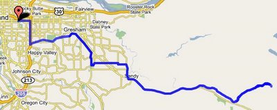 The last day started off grey. The clouds that had chased us off the ridge the day before had established themselves to the horizon, and packing up I felt a couple ominous drops. We broke camp and enjoyed the steady descent down the Muddy Fork Road, and then down Lolo Pass Road to the Barlow Road. The Barlow Road is another route that I was introduced to by the Barlow Century, and I think it's an absolutely wonderful piece of pavement. Easy going up, speedy going down. Fun twists to keep it interesting, but no turns that require you to even think about reaching for your brakes. Gorgeous scenery, gorgeous surface, low traffic, and keeps you from having to do Highway 26. What's not to love?
We've done a couple of trips just out to Lost Creek before, and it's a great 2 or 3 day excursion. Usually we lift the Barlow Century route wholesale, and take roads that go over a hill called The Devil's Backbone each way. But with the weather going bad, I wanted to get home, so we got onto Sleepy Hollow Road, and took that to 26. We pushed on up 26 to Sandy. There are a couple other back roads that parallel 26 that might have worked (Cherryville, etc.), but I didn't think it would be a good idea to go exploring, under the circumstances. I'll have to go look at them before the summer's out, though. In Sandy, we got on Bluff Road, and turned left on Dunn to 352nd, and then onto Compton, which took us straight into Boring. This turned out to be a reasonable route between Sandy and Boring that doesn't require you to get on Highway 26. Nice!
From Boring, we just picked up the Springwater, and from there, the ride home is a pretty trivial exercise.
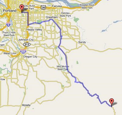
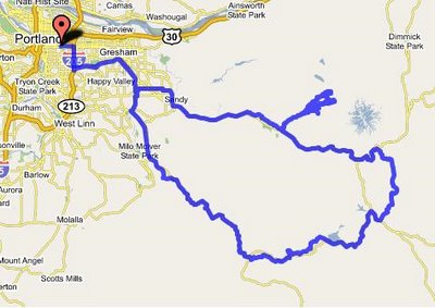 Here's a map of the whole route.
I would highly recomend this loop to the novice bike tourist. The days are 50 miles or less, the roads are quiet and pretty, and there are lots of camping options so you can always knock off early if a day is too much for you, or later if you want to keep pedaling. Plus, if you take the Devil's Backbone option (which I'll illustrate in a future post), the only time you're climbing on Highway 26 is between the 26-35 junction and Government Camp. The rest of the time, you hardly even have to think about cars. Good stuff!
Here are the rest of my photos.
Here is a link to the route in the gmaps pedometer.

0 Comments:
Post a Comment
<< Home